Creating Guides
Before creating a guidance line, check that the vehicle and implement dimensions are correct and that GNSS is working with no alerts and a green status, without messages such as “GNSS Synchronising”, “GNSS not communicating”, “No Glide”, “No RTK”, or fewer than 4 satellites.
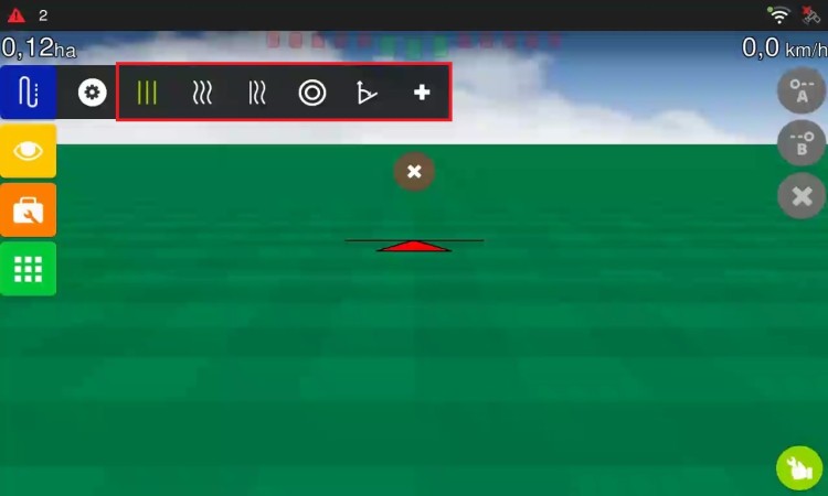
The display works with six types of guidance:
-
Parallel Straight Line (A-B): Defines a straight line in the field. All working lines will be parallel to it. Mark Point A at the start and Point B at the end. The minimum distance between A and B is 30 metres, with a maximum of 20 km. Lines to the right are positive (+), and lines to the left are negative (-).
-
Parallel Curve: Stores the actual path travelled between A and B, instead of a straight line. All following lines will be parallel to the original curve. Ideal for areas with gentle curves. Minimum distance: 30 m; maximum: 20 km.
-
Adaptive Curve: Provides guidance along the curve and updates the guidance line after each pass, taking the deviations made into account. It continuously records the path and adapts the guidance to match the last path travelled. Useful for irregular areas where the operator needs to steer around obstacles.
-
Pivot: For areas with centre-pivot irrigation. The working lines are concentric circles, defined by three points (A, B, and C) on the circumference. The parallel lines are generated according to the implement width.
-
A + Angle Straight Line: Defines a line using a starting point and an angle relative to North (0° to 360°), or relative to an already saved parallel straight guidance line. Ideal for creating lines with precise guidance without having to travel across the field.
-
Enter coordinates (Parallel Straight Line): Allows you to create a straight line (A-B) by manually entering the latitude and longitude coordinates of points A and B, without having to travel across the field. To access it, select the Parallel Straight Line tab and press the “+” button.
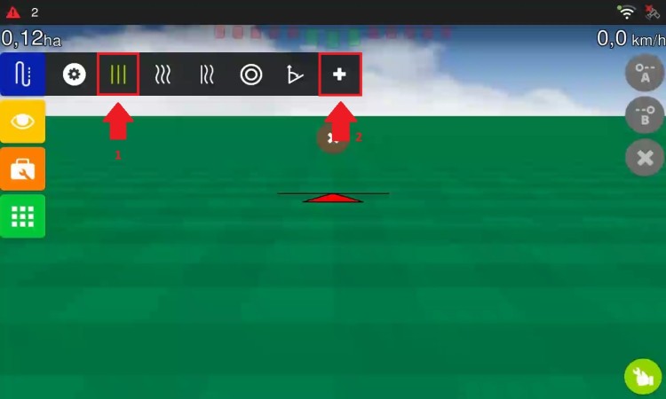
A screen opens for entering the coordinates of both points.
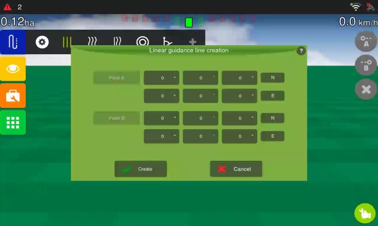
The straight line is created between the points entered, and the parallel lines are calculated automatically.
For all types, you can cancel guidance line creation at any time by selecting the option with “X”.